
I. IN BRIEF
This section is a brief summary to help you quickly access the key information you need. If you want to dive deeper into the details, simply continue with the rest of the article.
The Icarus Toolbox navigation log is intentionally conservative rather than highly precise.
Exact calculations can always be performed using detailed wind models and leg-by-leg wind correction angles, but these calculations remain inherently uncertain because forecasts are only forecasts. Wind, route, altitude and aircraft performance often differ from what was planned.
Other navigation logs are freely available online and offer far more complex and time-consuming calculations for those seeking maximum theoretical accuracy.
For a typical flight of up to two hours, with legs no longer than 30 NM and good visual ground references, this navigation log provides a level of accuracy that is fully adequate for the intended purpose.
Our philosophy is to stay on the safe side: use simple, conservative assumptions to produce a navigation log that is quick to prepare, easy to use in flight and robust against real-world variations.
If higher precision is required, pilots may refine their calculations, but this usually comes with reduced margins. In real operations, safety is achieved not by theoretical accuracy, but by conservative planning, continuous monitoring and good decision-making.
Disclaimer:
Use at your own risk. This navigation log is provided as a practical tool and does not replace proper training or instruction. Test and validate this log with your flight instructor or in a simulator to ensure it suits your operational needs.
II. Icarus Toolbox Navigation Log
Icarus Toolbox aims to make your life simpler, not more complicated.
Many navigation logs available online are unnecessarily complex.
Yes, they can provide very precise results, and that level of detail is perfectly appropriate if you are undergoing CPL training.
However, in real-life operations, many pilots simply do not use these complex navigation logs because they:
-
- take a significant amount of time to prepare;
- add workload without a proportional safety benefit.
We believe that time saved during preparation is time reinvested in safety.
Our goal is to help you reduce time spent on overly detailed navigation calculations, so you can focus instead on what truly matters for safe operations, such as:
-
- minimum fuel planning (see: Minimum Fuel Requirements in NCO);
- density altitude calculations in hot weather conditions (see: Understanding Altimetry – A Practical Guide for Private Pilots);
- take-off performance, landing distance and climb gradient assessment (see: Take-off and Landing Distance Calculation and Climb Gradient Requirements).
Most navigation logs found online focus primarily on theoretical navigation accuracy.
In practice, forecasts are not always representative of real conditions.
Wind, for example, can be completely different, or even opposite, inside a valley compared to the general forecast:
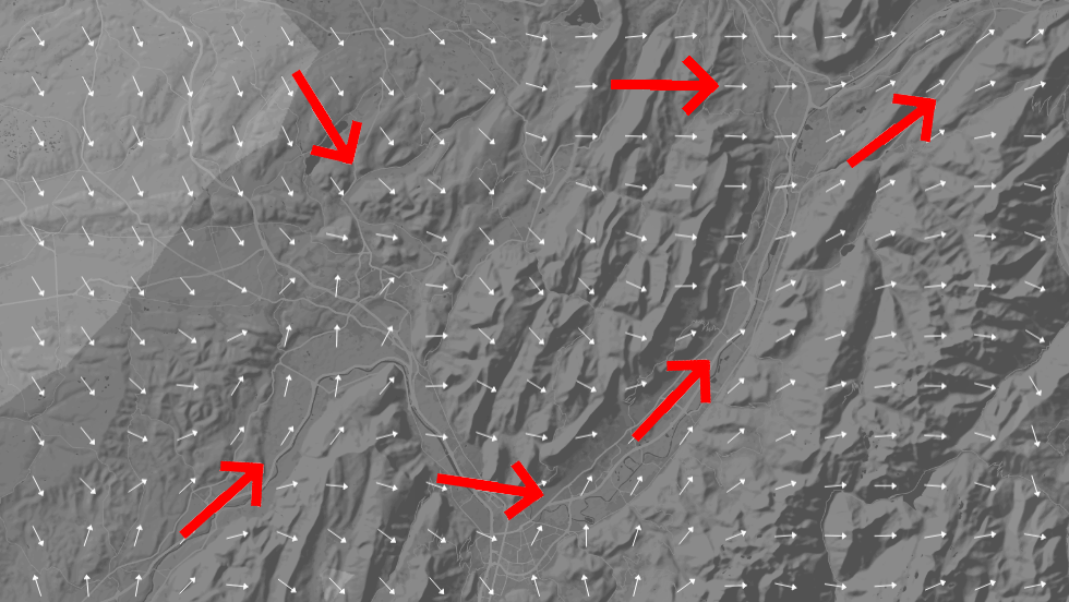
Source: www.windfinder.com
For this reason, Icarus Toolbox navigation logs are designed to be practical, realistic and usable in real cockpit conditions, not just accurate on paper.
III. METHOD PROPOSED BY ICARUS TOOLBOX – NAV LOG PHILOSOPHY
III.1 GROUND SPEED ESTIMATION
For ground speed estimation, we take into account the strongest headwind expected during the flight. We assume this headwind applies for the entire route.
This approach is deliberately conservative and places the planning on the safe side.
Many navigation logs available online calculate a different ground speed and time for each leg based on the exact headwind component. While theoretically correct, this adds complexity with limited operational benefit. We deliberately avoid these calculations.
III.2 WIND CORRECTION ANGLE ESTIMATION
It is possible to calculate an exact wind correction angle for each leg, as some navigation logs do.
For example, with a 20 kt crosswind and a TAS of 120 kt, the correct wind correction angle is approximately 10 degrees. On a 20 NM leg, an error of 10 degrees results in a lateral deviation of about 3 to 4 NM if no correction is applied.
In our navigation log, we use true track to keep things simple.
Once in the aircraft, you select a distant visual reference aligned with the planned true track and fly towards it. You also use clear visual references that are identifiable both on the chart and from the air, depending on the selected altitude. Corrections are then made as required. Simply pointing the nose of the aircraft in the right direction is already a very effective method in real-life VFR navigation.
For the PPL skill test, the expected level of precision is ±10 degrees.
III.3 TRUE TRACK VS MAGNETIC TRACK
The planned ground track used in the navigation log is the true track. In France, magnetic variation is typically around 1 to 3 degrees and is negligible for real-life VFR navigation.
However, for the PPL theoretical skill test, headings are expected to be calculated to the nearest degree, including the application of magnetic variation.
Icarus Toolbox deliberately avoids overly complex navigation logs.
Meteorological forecasts are not always linear or accurate, and human flying precision is never perfect, especially when flying manually without an autopilot. Our objective is therefore to provide a method that is simple, realistic and conservative. As shown above, our method simplifies calculations and remains conservative.
If fuel capacity or aircraft performance does not allow the flight to be completed with comfortable margins, calculations may be refined. However, increased precision usually means reduced margins. When Minimum Fuel Required approaches the maximum usable fuel, the situation becomes less forgiving. In such cases, it may be wiser to plan a short stop en route and continue the flight with peace of mind, especially if weather conditions are not CAVOK throughout the route.
If you operate close to fuel or performance limits, refined calculations must always be accompanied by appropriate contingencies.
These may include alternates, route reductions or other operational options.
IV. What is really Important in your Navigation Log
The essentials are:
-
- turning points (waypoints)
- distance, time and track between waypoints
- minimum altitude for each leg, for safety (e.g. in case of IMC)
- selected altitude based on airspace, weather and terrain (see our article: Airspaces and Air Traffic Services – What Pilots Need to Know)
- fuel management, which remains one of the major causes of aviation accidents
- frequencies: not mandatory, but extremely useful to anticipate, prepare and reduce workload in flight, which directly improves safety.
Fuel planning includes not only the total fuel required for the flight, but also the Minimum Fuel Required (MFR) at each waypoint. MFR is the minimum fuel required to reach destination with MIN DIV available.
MIN DIV (minimum diversion fuel) is defined as:
- alternate fuel plus final reserve
- (or final reserve only if no alternate is planned)
V. How to use our Nav Log
V.1 NAV LOG – COLUMN DEFINITIONS
FREQ. & AREAS :
WAYPOINT :
TRACK :
However, for the PPL skill test, headings are expected to be calculated to the nearest degree.
DIST :
TIME :
Q :
ETA :
ATA :
FOB :
MFR :
REMAINING DIST :
REMAINING TIME :
V.2 STEPS
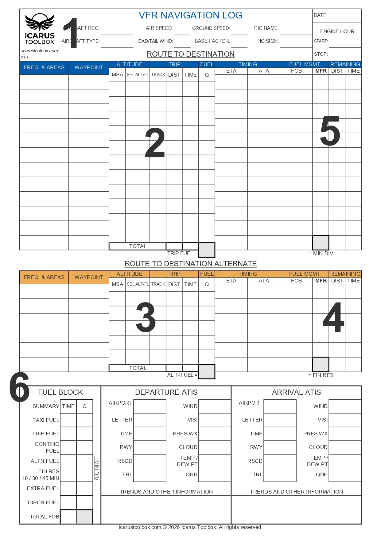
STEP 1 - AIRCRAFT DATA AND TIMING BASIS
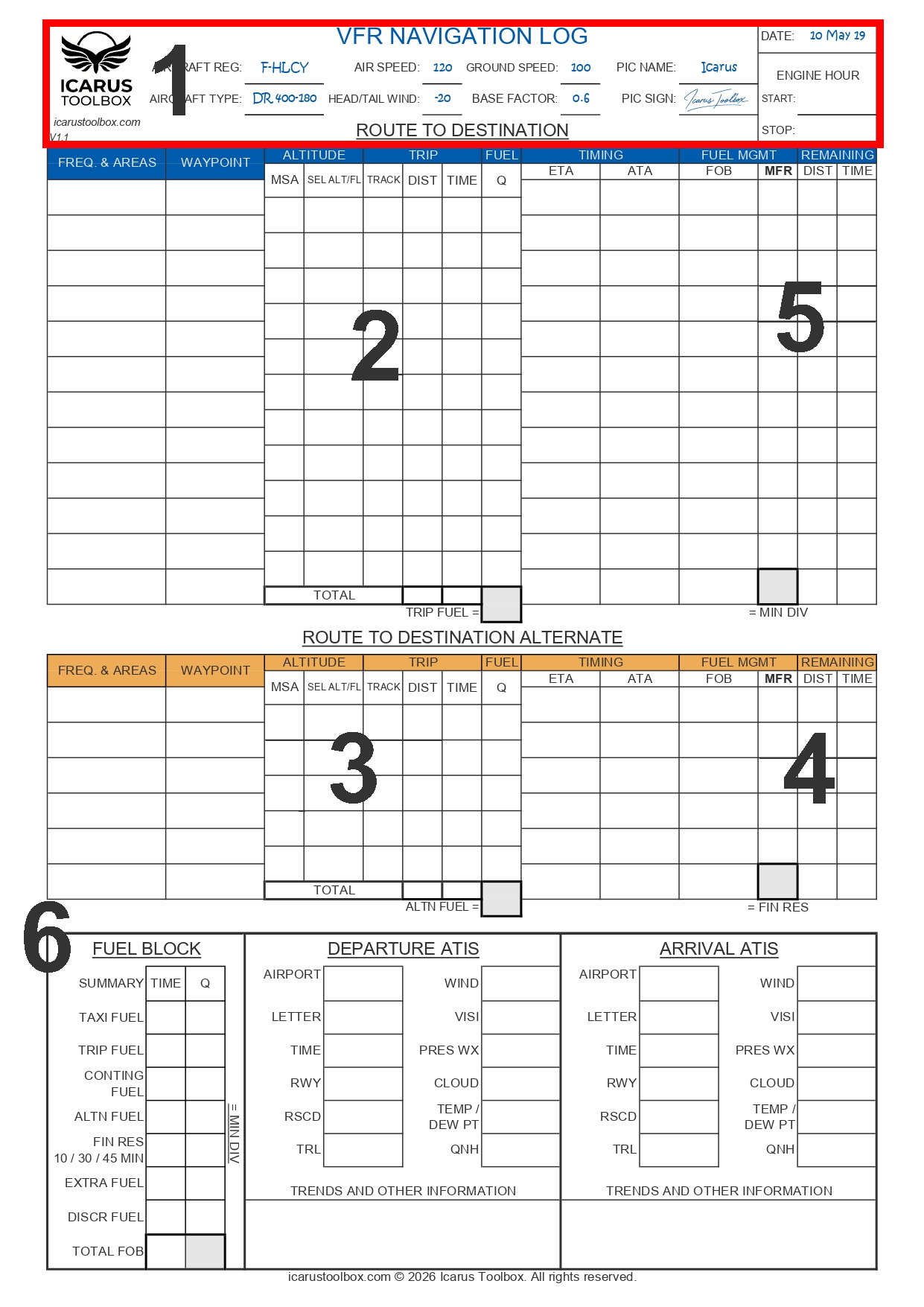
Enter the aircraft data, including TAS and the estimated ground speed based on the average wind
expected for the flight. Calculate the base factor used for timing calculations:
Base factor = 60 / GS
Example:
GS 100 kt → 60 / 100 = 0.6 min per NM
- Time calculation example: 13 NM × 0.6 = 8 minutes
- Fuel example: With a fuel consumption of 40 L/h, 8 minutes corresponds to approximately 5.3 L. In practice, we round up to 6 L.
You may use Excel for more precise values and rounding, provided the total block fuel remains
conservative.
Astuce:
For a return flight, if the forecast headwind is 20 kt and variable in direction, simply reduce TAS
by 20 kt for the entire route to obtain a conservative ground speed. This approach remains on
the safe side.
STEP 2 – NAV LOG TO DESTINATION
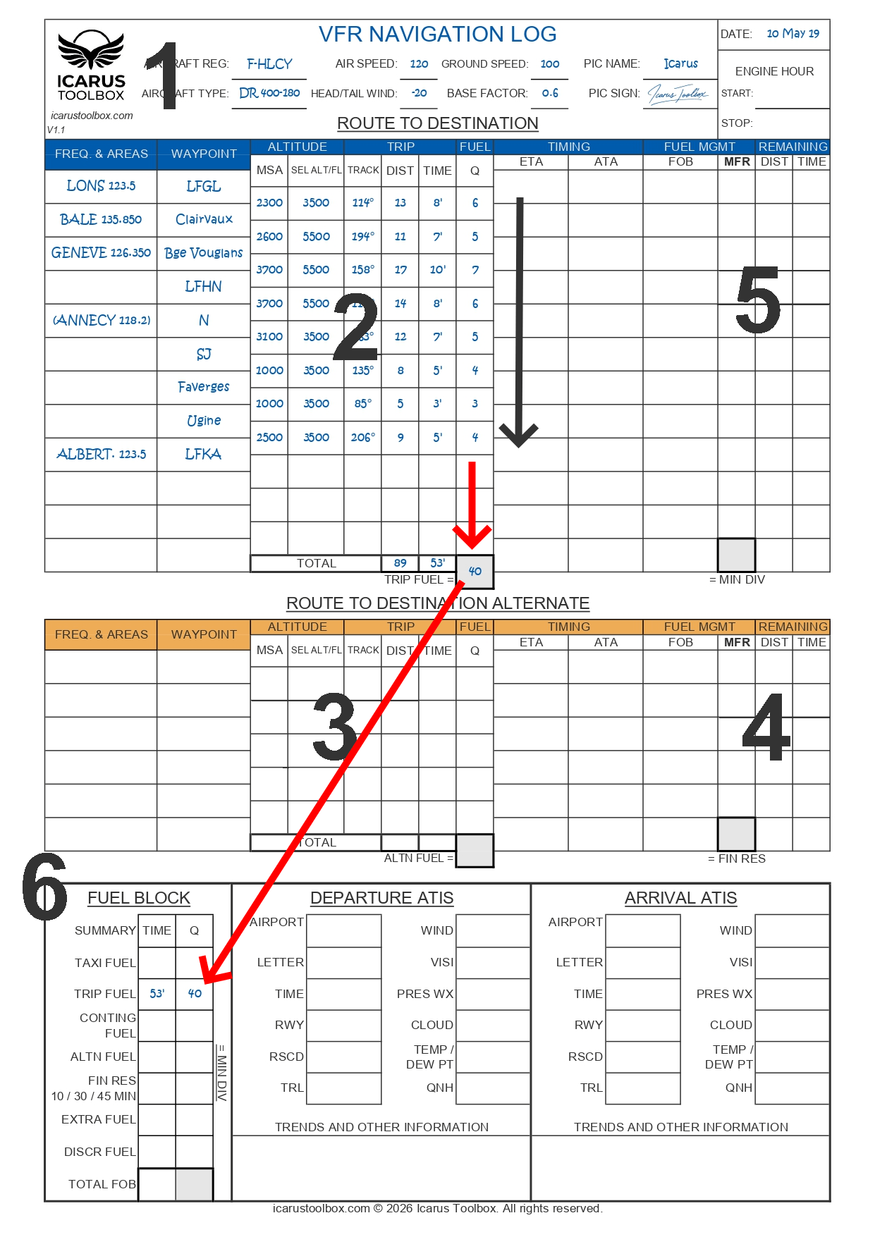
Complete the navigation log for the route to destination.
MSA: Minimum Safe Altitude for each leg.
SEL ALT / FL: Selected according to semicircular rules, airspace, weather and terrain margins.
Enter distance, time and fuel required for each leg.
At the end of this step, you will know:
- Total flight time
- Trip fuel
STEP 3 - ALTERNATE ROUTE
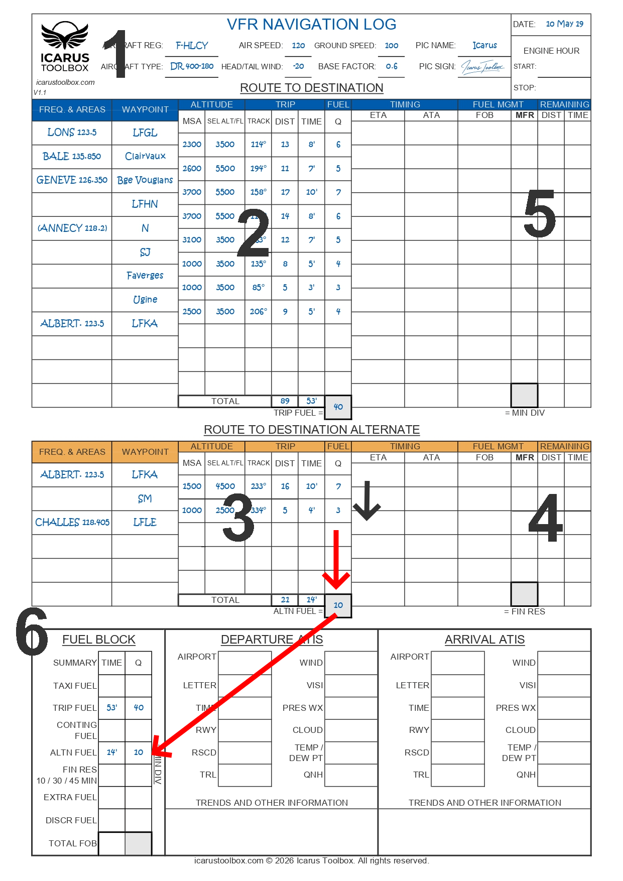
Complete the navigation log for the route from destination to alternate.
This provides the alternate fuel (ALT FUEL).
STEP 4 - FINAL RESERVE AND MIN DIV
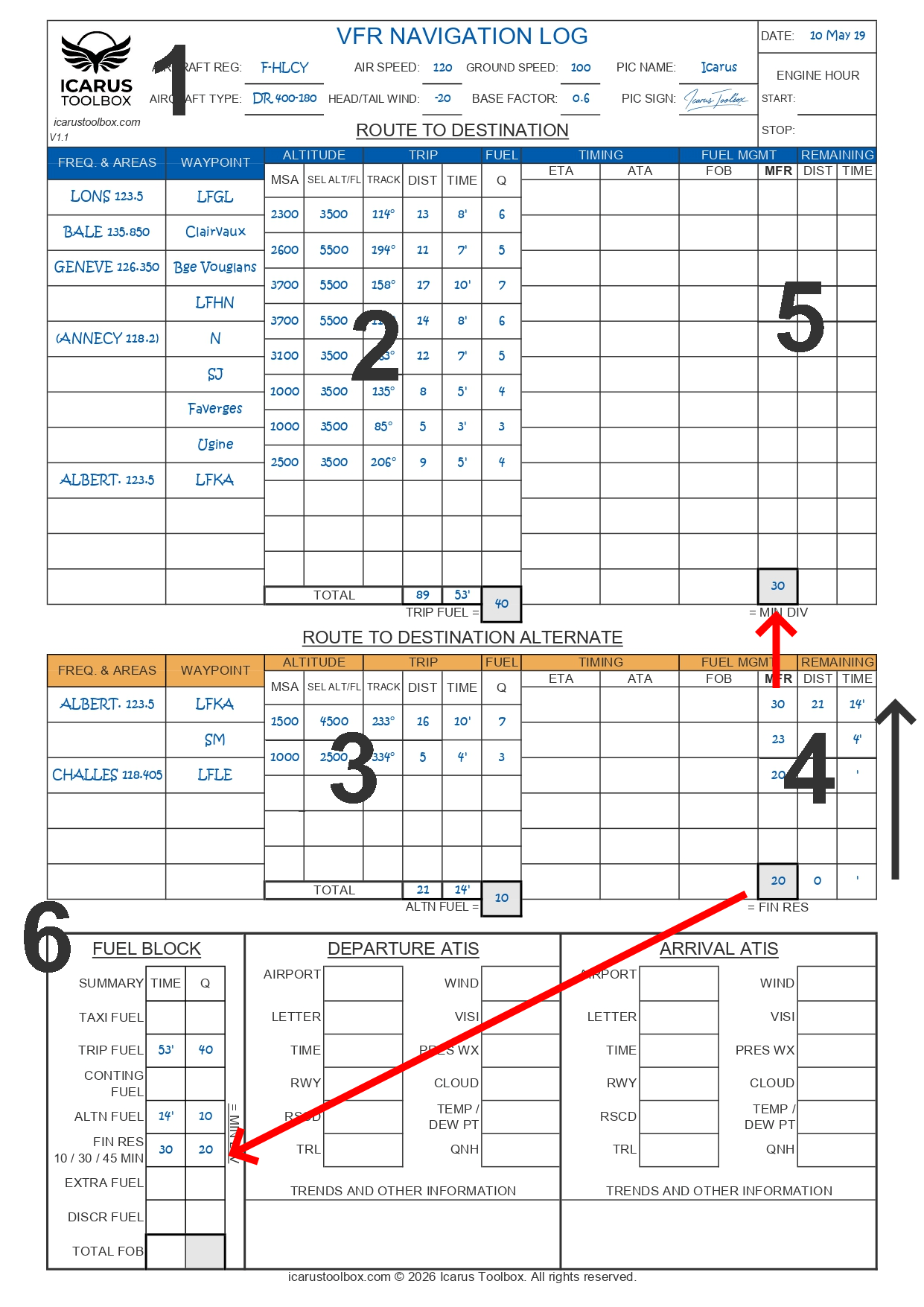
Determine the final reserve.
Example: 20 L corresponding to 30 minutes of flight.
Then work backwards through the log to calculate, for each waypoint:
- Remaining time to destination and alternate
- Minimum fuel required to reach the alternate while preserving the final reserve
Final reserve + alternate fuel gives the MIN DIV.
MIN DIV is the minimum fuel required upon arrival at destination to allow diversion to the
alternate and landing with final reserve intact.
STEP 5 - MINIMUM FUEL REQUIRED (MFR)
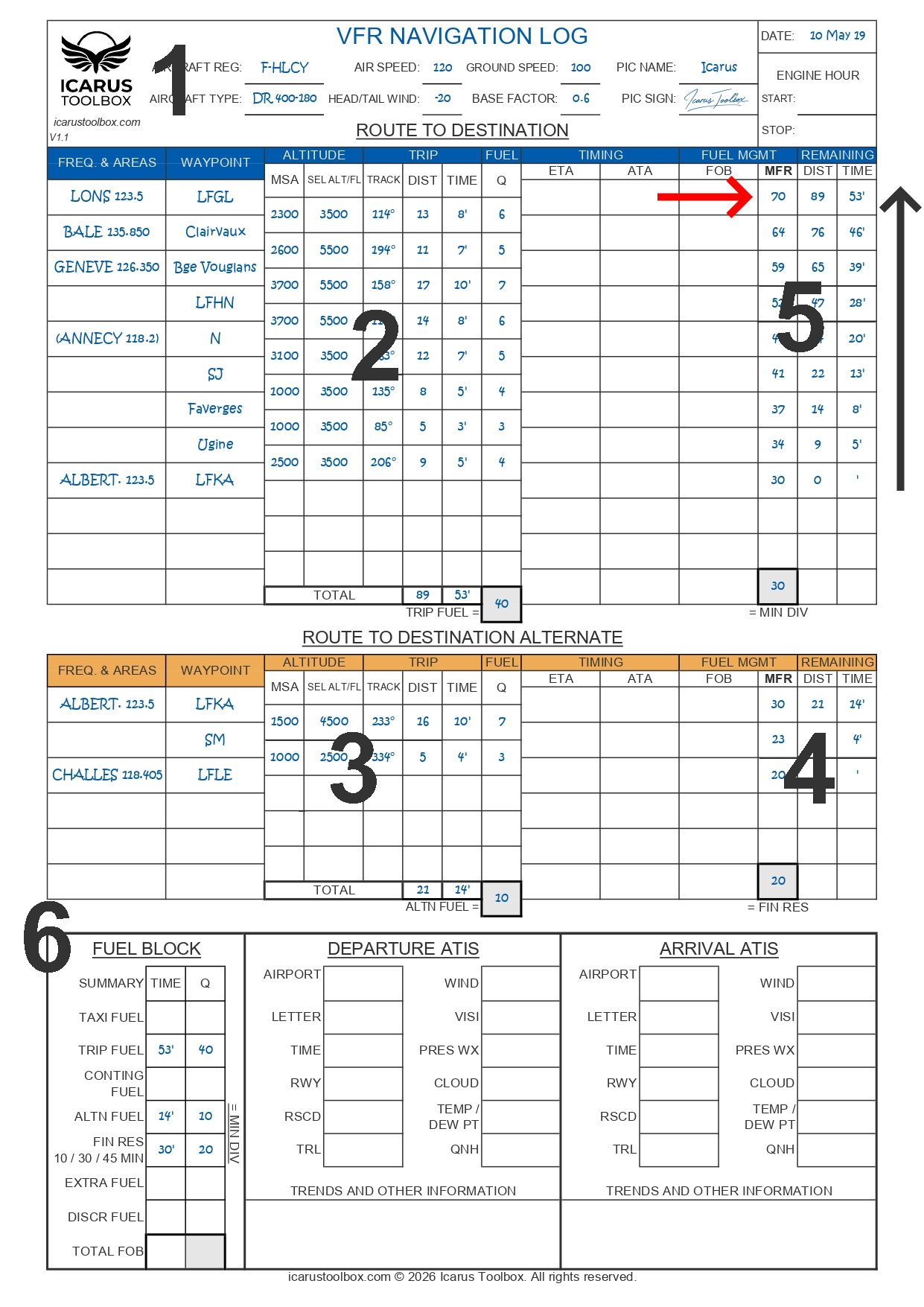
Continue working backwards through the log to calculate, for each waypoint:
- Remaining time to destination
- Minimum fuel required to reach destination while preserving MIN DIV
At the top of the log, you obtain the Minimum Fuel Required (MFR) for the entire flight.
(mettre BLOCK Attention)
MFR does not include margins, taxi fuel or expected delays.
STEP 6 - BLOCK FUEL CALCULATION
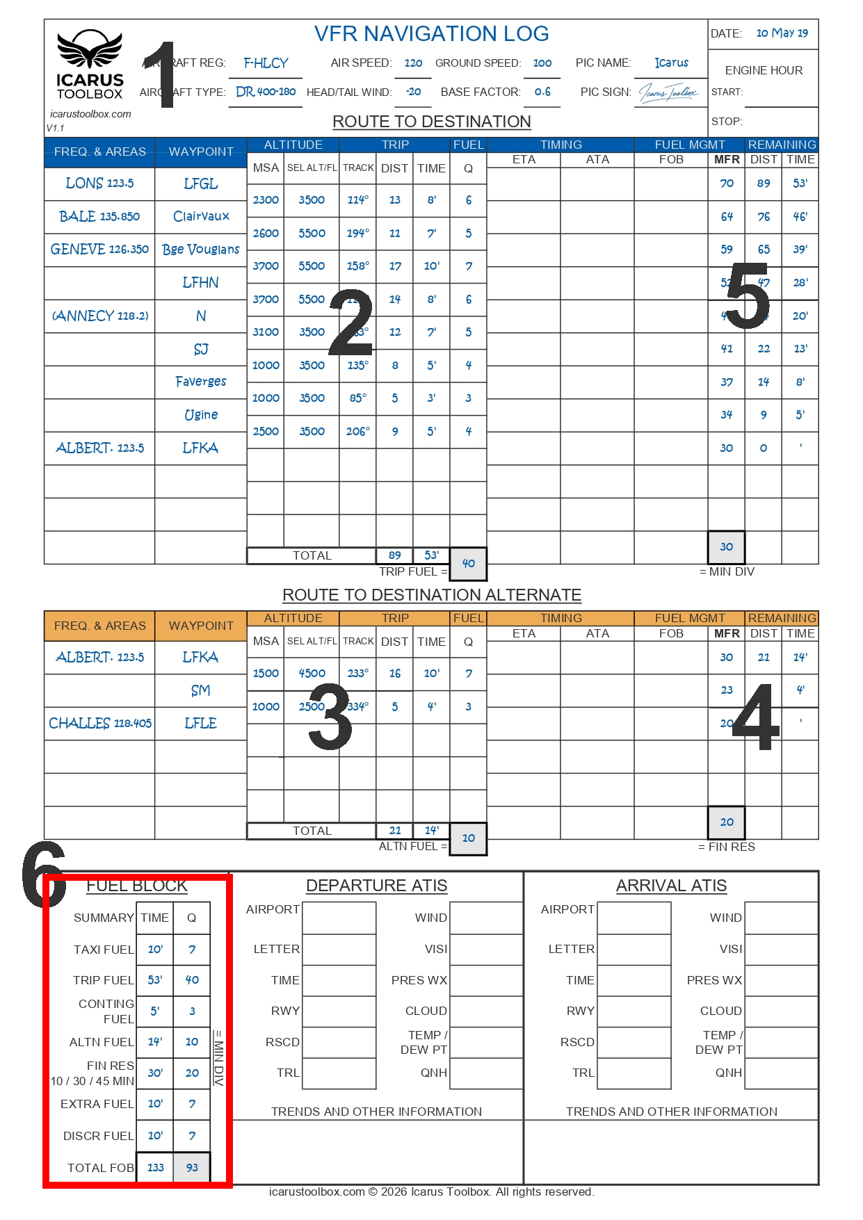
Calculate the block fuel in accordance with fuel planning rules (see: Minimum Fuel
Requirements in NCO).
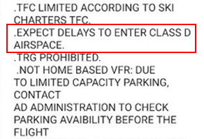
Example assumptions:
- 10 minutes taxi and engine warm-up at cruise consumption
5 minutes margin on the departure-to-destination leg - 10 minutes extra for potential holding or airspace constraints (e.g. Geneva area)
- 10 minutes additional reserve for a possible go-around or extra circuit at destination
V.3 IN-FLIGHT MONITORING
Fuel and timing are monitored continuously in flight.
Example:
-
- Main tank 110 L + approximately 10 L in the wings.
- According to the flight manual, 10 L are unusable, leaving 110 L usable fuel.
Fuel monitoring is critical. A leak or overconsumption can quickly lead to a serious situation.
The MFR column represents the absolute minimum fuel required at each waypoint.
If fuel on board drops below MFR, it means the aircraft will arrive at destination with less than the planned fuel margins and reserves.
VI. References
AMC1 FCL.235